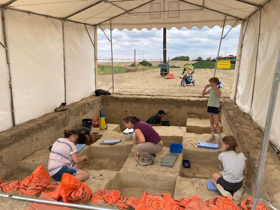
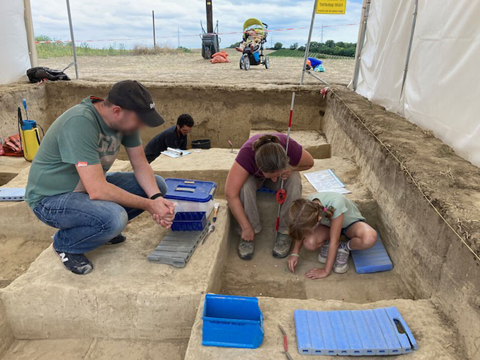
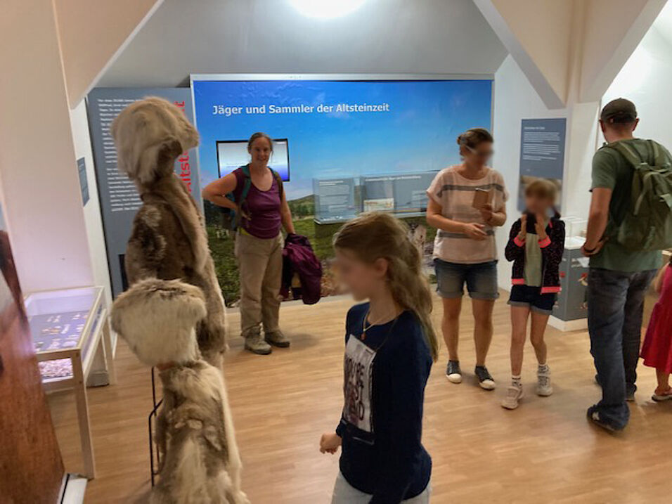
New open-access publication!

25.06.2024

New publication by PalArchGroup team members Marjolein D. Bosch and Philip R. Nigst

Our paper on our fieldwork in 2021 has just been published open-access in the journal Archaeologica Austriaca. You can download it for free here.

In 2021 we conducted fieldwork consisting of survey and excavation. In this paper we we summarize the findings of our fieldwalking survey conducted around the well-known Upper Palaeolithic (Gravettian) open-air site Grub-Kranawetberg I in Austria. The site is located about 40 kilometres northeast of Vienna. In September 2021, we surveyed around 126,000 square metres using GNSS (Global Navigation Satellite System) to piece-plot each find. In total, we recovered 359 finds comprising lithic artefacts and faunal remains. In our analysis we show that the state of the fields did not drive how many finds per cadastral parcel were recovered during our survey and did not bias the find density per cadastral parcel. The majority of finds hint at a Gravettian dating and occur in two concentrations on top of the hill west of the known site Grub-Kranawetberg I.

The research was co-funded by the University of Vienna and the Land Niederösterreich, Abteilung Wissenschaft und Forschung (project K3-F-530/005-2021).

Nigst, P. R., Antl-Weiser, W., & Bosch, M. D. (2024). Exploring the Surrounding of a Gravettian Site. The Case Study Grub-Kranawetberg, Austria. Archaeologia Austriaca. 10.1553/archaeologia108

Get it here for free.

Map showing the spatial distribution of finds in relation to the slope (in degrees) (slope calculated from a digital terrain model with 1 m resolution: © Land Niederösterreich; coordinate reference system: MGI/Austria GK M34 [EPSG code 31259]; GIS and graphics: P. R. Nigst). Original figure in: austriaca.at/0xc1aa5576_0x003f2ff4.pdf

Photos of fieldwalking survey in September 2021 (Photos: P. R. Nigst), changed after original figure in: austriaca.at/0xc1aa5576_0x003f2ff4.pdf

Map showing the surveyed cadastral parcels (red outline) on top of the orthophoto and cadastral map; excavation trenches of Grub-Kranawetberg I and II are shown for reference (Cadastral map [Digitale Katastralmappe]: © Bundesamt für Eich- und Vermessungs- wesen; areal images/orthophotos: © Land Niederösterreich; hillshade calculated from a digital terrain model with 1 m resolution: © Land Niederösterreich; coordinate reference system: MGI/Austria GK M34 [EPSG code 31259]; GIS and graphics: P. R. Nigst). Original figure in: austriaca.at/0xc1aa5576_0x003f2ff4.pdf

Kernel Density Estimation maps of all finds recovered during our survey. Excavation trenches (blue) of Grub-Kranawetberg I and II are shown for reference (Elevation and hillshade calculated from a digital terrain model with 1 m resolution:

© Land Niederösterreich; coordinate reference system: MGI/Austria GK M34 [EPSG code 31259]; GIS and graphics: P. R. Nigst). Original figure in: austriaca.at/0xc1aa5576_0x003f2ff4.pdf

Pleistocene faunal remains. – a. Fissidentalium badense (GK-2-71). – b. Enlarged apical view of the Fissidentalium badense (GK-2-71) with the two notches highlighted (arrows). – c. Fragments of mammoth ivory: 1. GK-4-61b; 2. GK-3-41; 3. GK-1-40 (Photos and graphics: M. D. Bosch, A. Kurzawska, P. R. Nigst). Original figure in: austriaca.at/0xc1aa5576_0x003f2ff4.pdf

Selected retouched tools. – 1. Backed bladelet fragment (GK-5-14). – 2. Backed blade (GK-2-81). – 3. Backed blade (GK-2-32). – 4. Backed piece (GK-2-46). – 5. Retouched blade (GK-1-9). – 6. Pointed retouched blade (GK-1-68). – 7. Point (GK-2-22) (Photos and graphics: M. D. Bosch, P. R. Nigst). Original figure in: austriaca.at/0xc1aa5576_0x003f2ff4.pdf